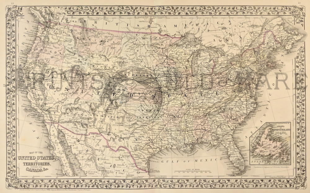
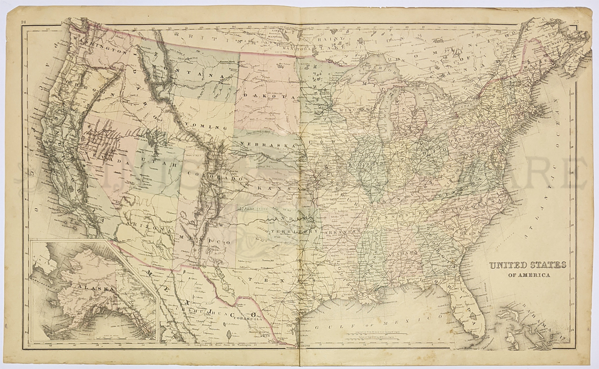
231UnitedStates:
1879 Mitchell's original
hand colored Map of the United States and Territories Together with
Canada & C. Inset of Island of Newfoundland on bottom right.
Entered according to Act of congress in the
Office of the Librarian of
Congress at Washington.
23 x 15 in. $180
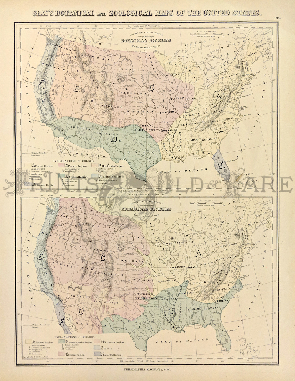
006us:
1878
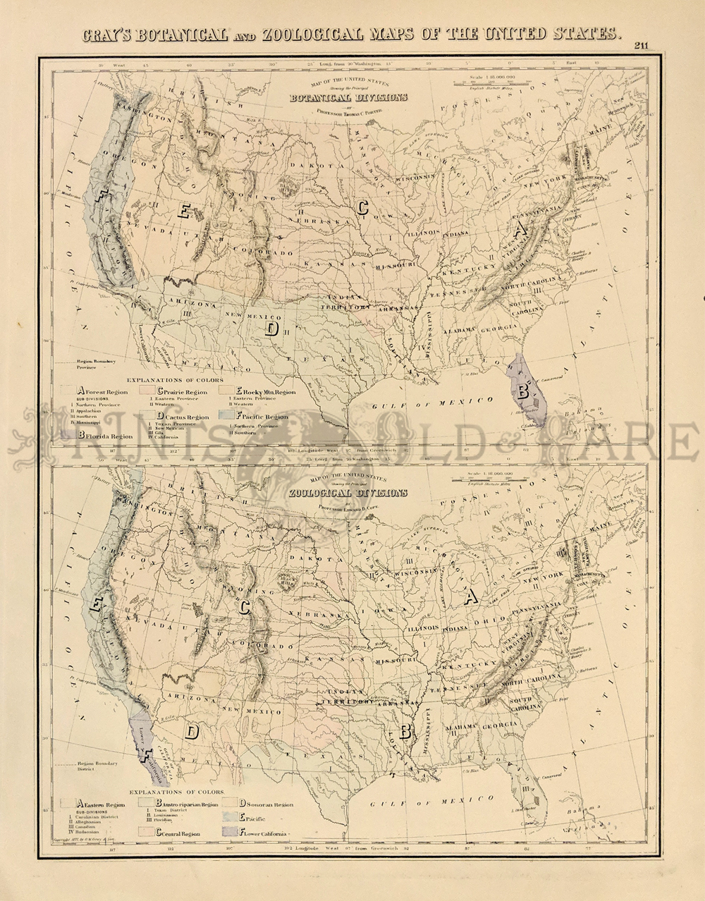
Botanical - Zoological Maps of the USA. These two maps of the United
States were published in Gray's Atlas of 1876. The top map is titled
"Map of the United States Showing the Principal Botanical Divisions."
The bottom map is "Map of the United States Showing the principal
Zoological Divisions. Each botanical and zoological area is identified
by a different color.
14" x 17" $80
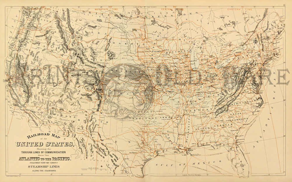
007us:
1889
Railroad Map of U.S. Scribner & Sons, attractive color litho.
An
amazing number of old railroad lines shown in red throughout
country.
26x17-1/2 in. $80
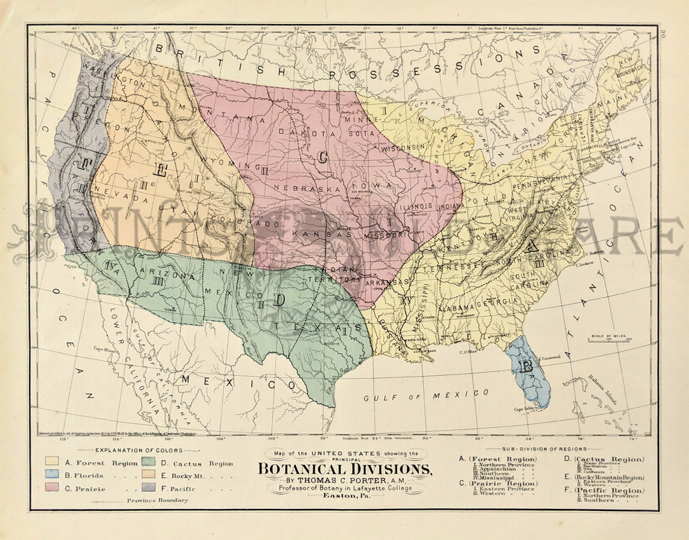
008us:
1873
Botanical Divisions (US) Map. Regions shown by hand coloring. Divided
into Forest, Prairie, Cactus, etc. Published by O.W. Gray. 17x14-1/2
in. $60
009us:
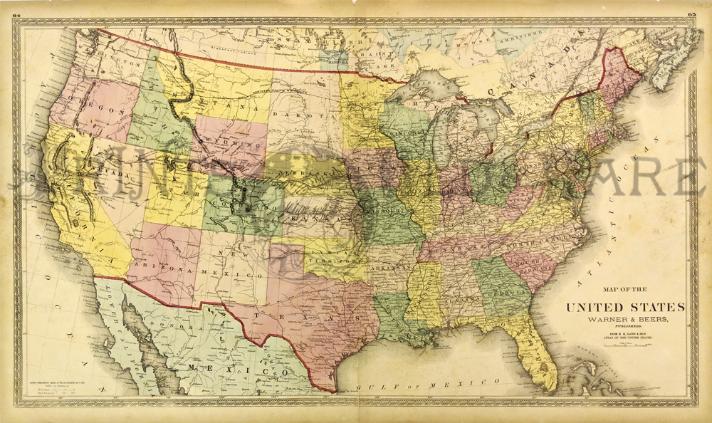
1873 Large Warren and Beers US Map. Original color. Attractive border
(a few light foxing
spots on oceans).
30x18 in. $120
012us:
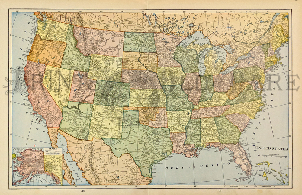
1901
Color Map of USA - NO RESERVE! Great old color map of the United
States, produced in 1901. Each state in its own color. Shows railroads,
topography, major cities. Inset of Alaska. 99 years old!
22x15 in. $50
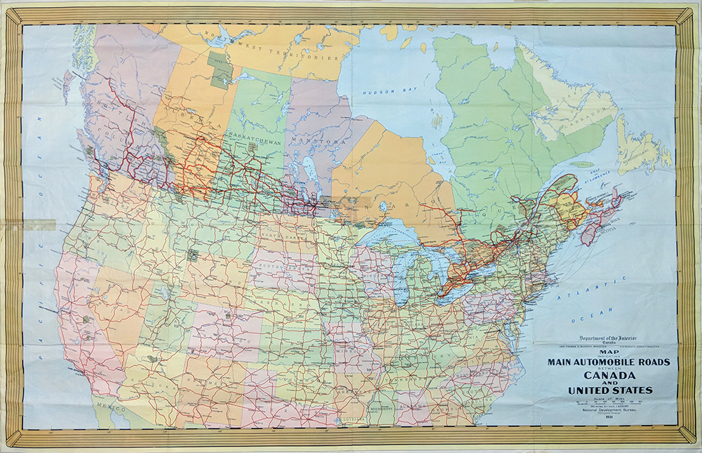
017us:
1931 Department of the Interior Canada. Map indicating
Automobile Roads between Canada & United States.
40 x 26 1/2 in. $120
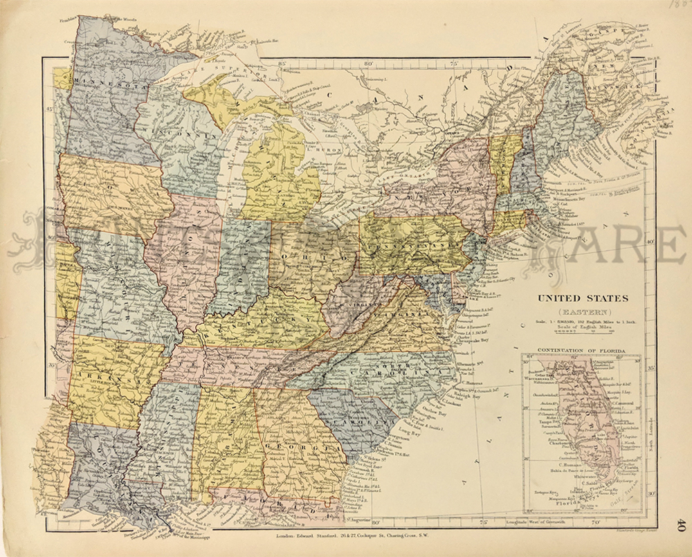
019us:
1884 MAP OF EASTERN UNITED STATES. Original hand colored antique
English map, showing the eastern United States as far west at Missouri.
Very
attractive antique engraving.
14-1/2" x 12" $80
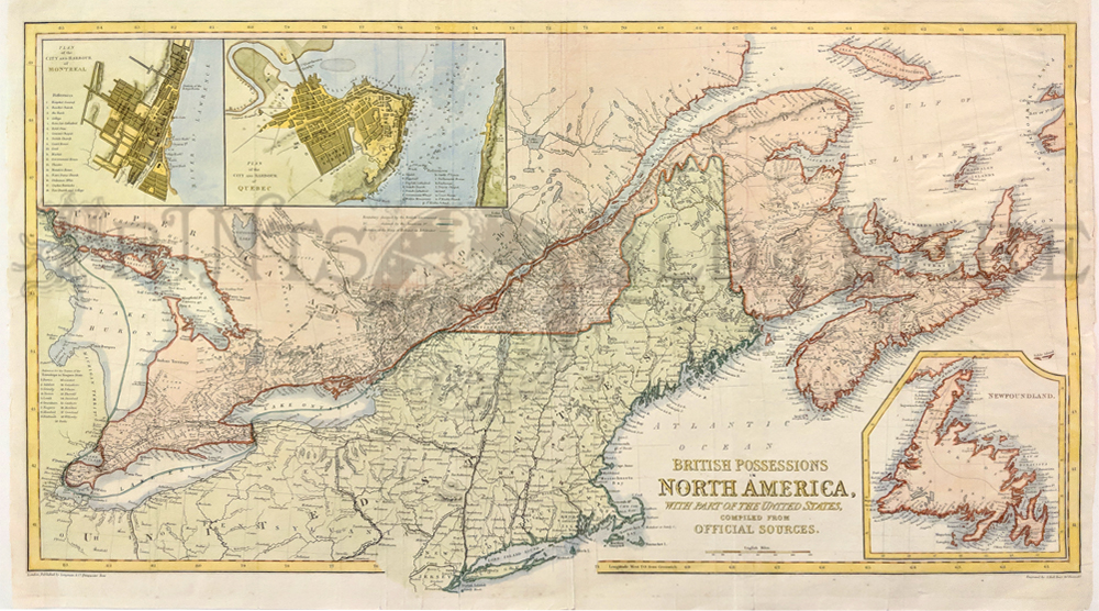
020us:
1860 British Possessions in North America. New York and
New England. Large hand colored English map with insets of Montreal,
Quebec City and Newfoundland.
26x16 in. $150
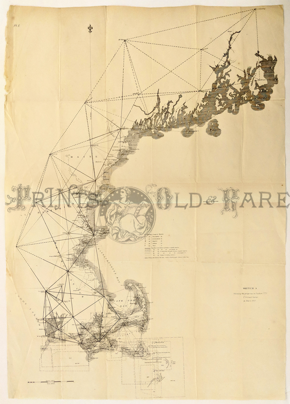
024us:
1850 New England Triangulation Chart. Early chart of the New England
coast. Published in black & white from surveys
taken from 1844 to 1850.
22-1/2x32 in. $120
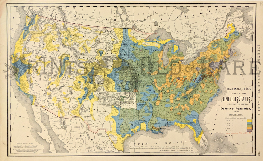
025us:
1892 Population Density Map. Interesting map shows population density
by color. Also shows movement of center of population from 1790 to
1890. (Average density in 1890 was up to almost 21 persons per square
mile!) 21x14 in. $80
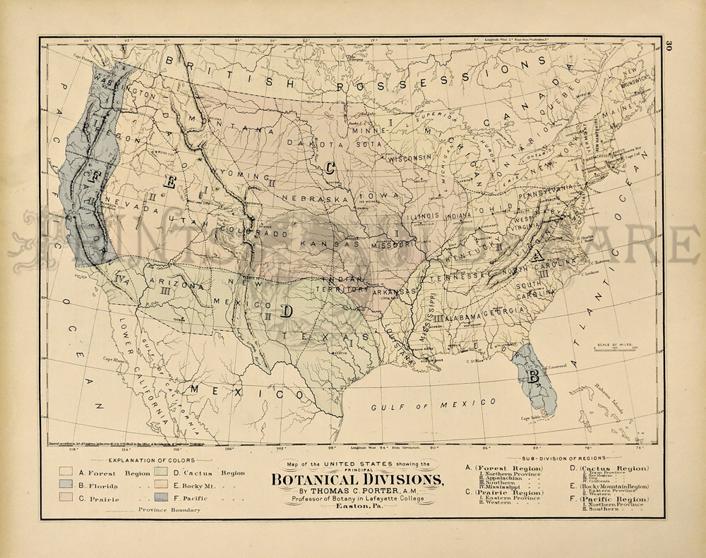
027us:
1875 Botanical Division Map of U.S. Hand colored for each region. By
Thomas Porter. Printed by Gray.
17x14-1/2 in. $60
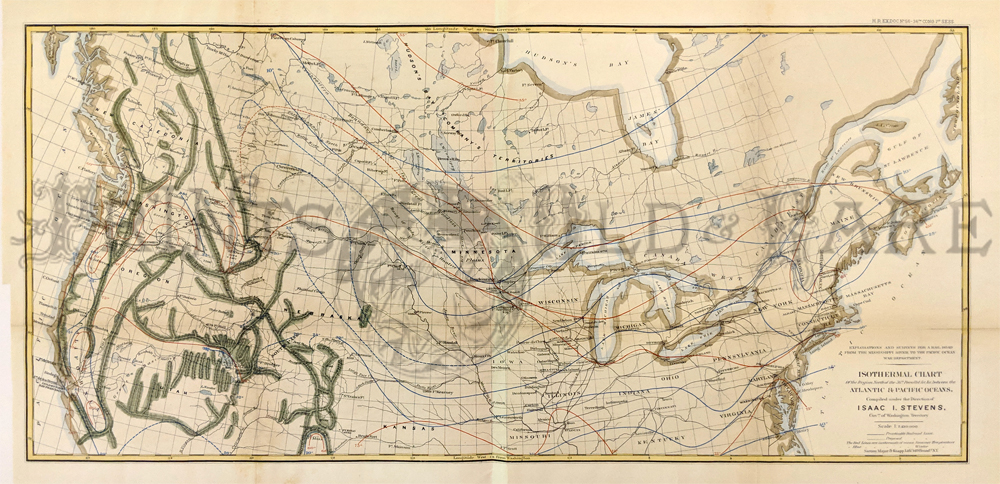
031us:
1860 Isotherm Chart ( map ) of U.S. Isotherm chart of
northern United States and Canada. Hand colored. By Isaac Stevens,
Governor of Washington Territory.
Published by U.S. War Dept.
29x16 in. $150
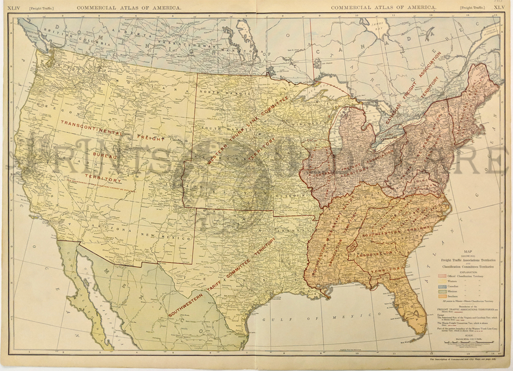
033us:
Railroad
Freight Rate Tariff Areas Map. Color litho map by Rand McNally. Printed
in color by region. All railroads shown. Large
28x21 in. $60
037us:
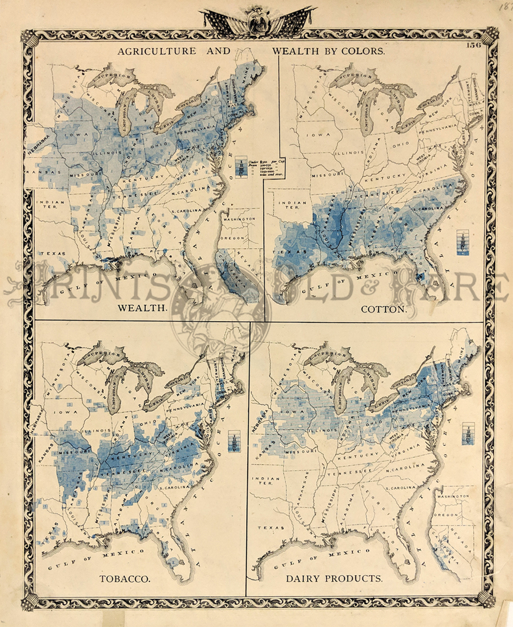
1876
Wealth and Agriculture U.S. Map. Early eastern United States, by
colors. Four maps on one page. Shows concentrations of wealth, and
industries of cotton, tobacco and dairy. Slight stain in upper margin.
Nice border.
14-1/2x17-1/2
in. $80
108NewHampshire:
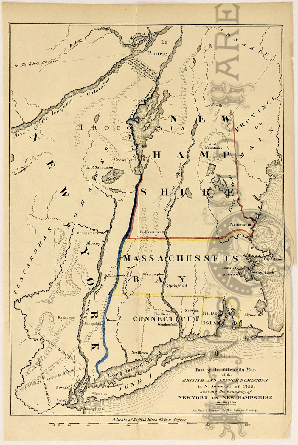
"Part of Dr. Mitchells Map of the British and French Dominions in N.
America of 1755, Showing the boundary of New York on New Hampshire."
Re-issue of a 1755 Map published in 1850 by Am. Photo-Lithographic Co.
NY. Hand colored lines showing the boundry between each of the
states. Cities, rivers and sounds are shown, along with limits and
division lines claimed.
9 x 13 1/2 in. $150
|

245UnitedStates:
Gray's Geological Map of the United States By Charles H. Hitchcock
PH.D. Professor of Geology in Dartmouth College. Colorful map of the
United States, exhibiting the geological regions, including Ecozoic,
Silurian, Devonian and Lower Carboniferous, Coal Measures and
Permo-Carboniferous, Triassic and Jurassic, Cretaceous, Tertiary,
Alluvium and Volcanic, each coded by color. 1881. Hand colored,
lithograph. **Minor pen marks near top right border.
16 1/2 x 27 in. $120
040us:
1876 Botanical - Zoological Maps of the USA. These two
maps of the United States were published in Gray's Atlas of 1876. The
top map is titled "Map of the United States Showing the Principal
Botanical Divisions." The bottom map is "Map of the United States
Showing the Principal Zoological Divisions." Each botanical and
zoological area is identified by a different color.
15" x 17" $100
235UnitedStates:
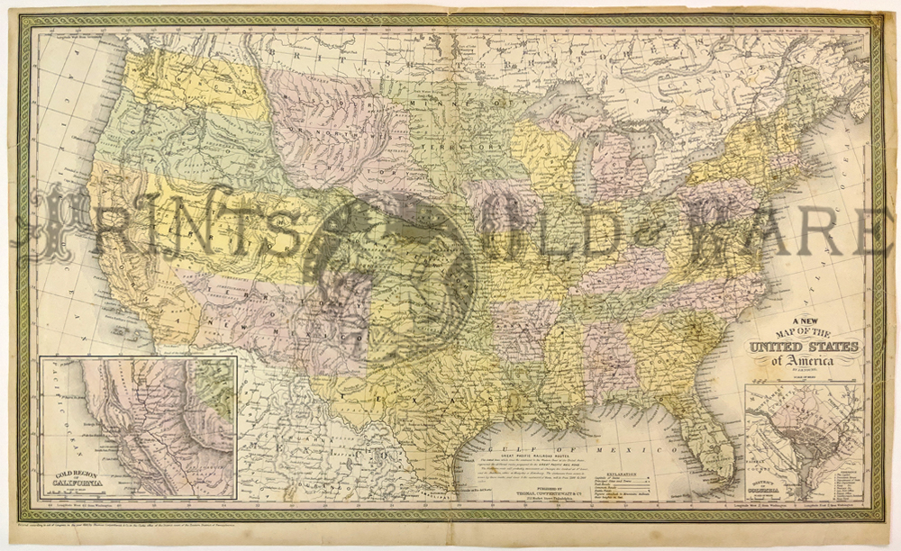
1850 Cowperthwait color United States map which shows the Gold Regions
of California on bottom left inset and an inset of Washington, D.C. on
bottom right. In this map, the west is mostly still territories. Top
right border has been repaired.
16 7/8 x 26 3/4 in. $650
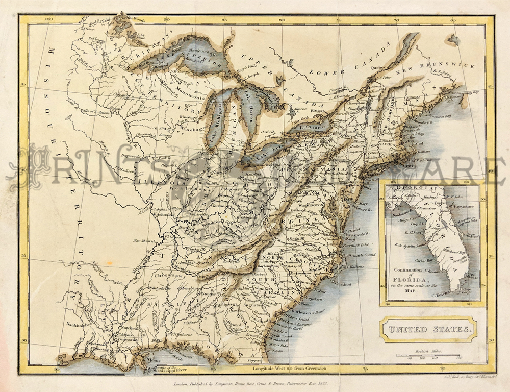
041us:
1822 Rare color Map of early United States with inset bottom right of
early Florida. Published by Longman, Hurst, Rees, Orme and Brown,
Paternoster Row.
10 x 8 in. $300
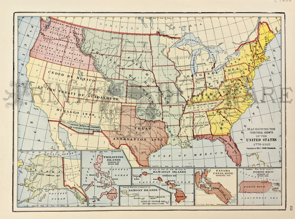
103us:
1912 Territorial Map of the United States,
published by the George F. Cram Company of Chicago. This color-coded
map shows the dates of acquisition for each piece of territory in the
continental USA. Inset maps at the bottom show dates of acquisition for
Alaska, the Philippines,
Samoan Islands,
Hawaii, the Panama Canal
Zone, and Puerto Rico.
12x15 in. $50
Check
for availability
108us:
1875
Map of the United States by Gray. Interesting map, with original hand
coloring, from O.W. Gray's world atlas of 1875. Each state is
separately colored. Cities, towns, railroad lines and geographical
features are all shown. Very attractive antique map which would look
great in a frame!
17x28 in. $150
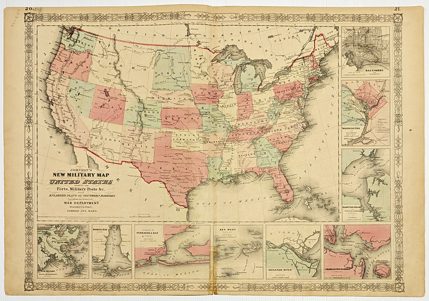
110us:
1861
Military Map of the United States. This interesting map of the United
States was published in 1861 by Johnson and Ward. The entire title of
the map is "Johnson's New Military Map of the United States Showing the
Forts, Military Posts Etc. with Enlarged Plans of Southern Harbors from
Authentic Data obtained at the War Department Washington." Forts all
over the country (including those in the Western states) are
marked
with a diamond symbol. **Bottom middle has tape residue/mark. Top
middle has been reinforced.
18x27 in. $300
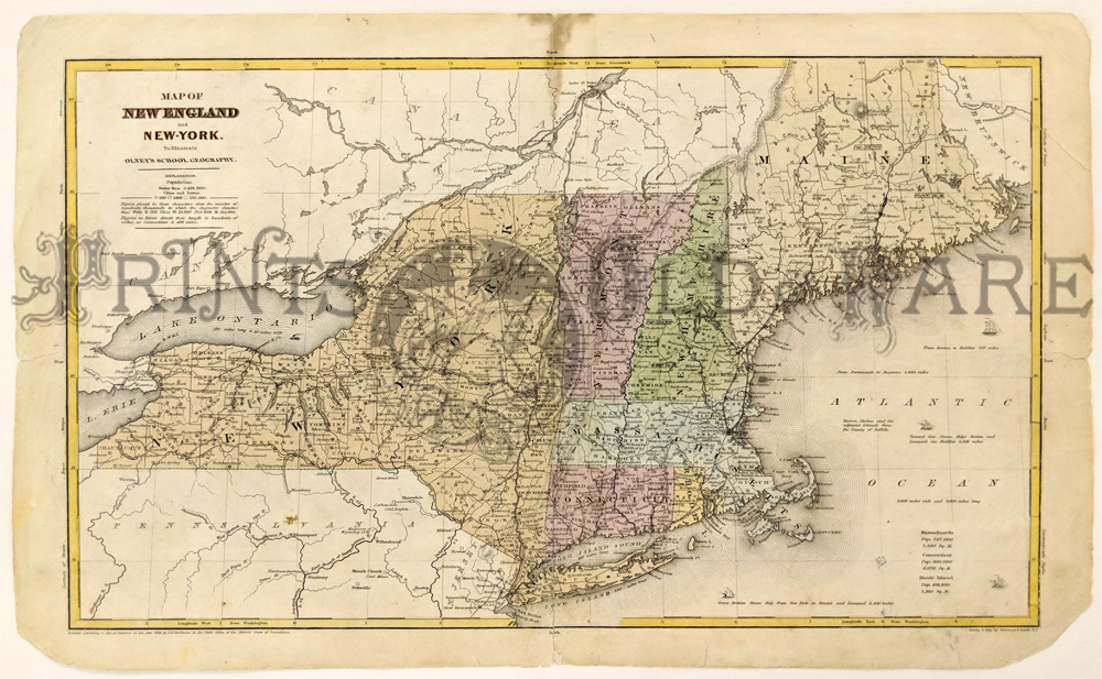
112us:
1844
Map of New England, New York. Hand colored map from the 1844 edition of
Olney's School Geography, drawn and printed by Sherman & Smith.
Shows the states of New York, Connecticut, Rhode Island, Massachusetts,
Vermont, New Hampshire and Maine. Cities, towns, railroad lines, canals
and geographical features are all shown. Populations of Massachusetts,
Connecticut and Rhode Island are listed in the lower right
corner.
12x19 in. $150
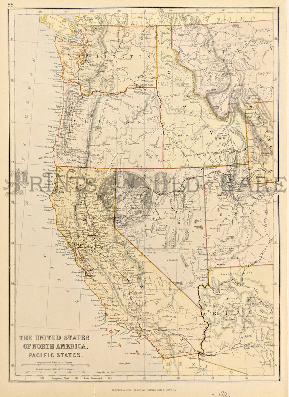
204us: circa
1880 Western State Map. The United States of North America, Pacific
States. This colored map shows Montana, Utah and Arizona west to the
Pacific coastline. 11x15 in. $60
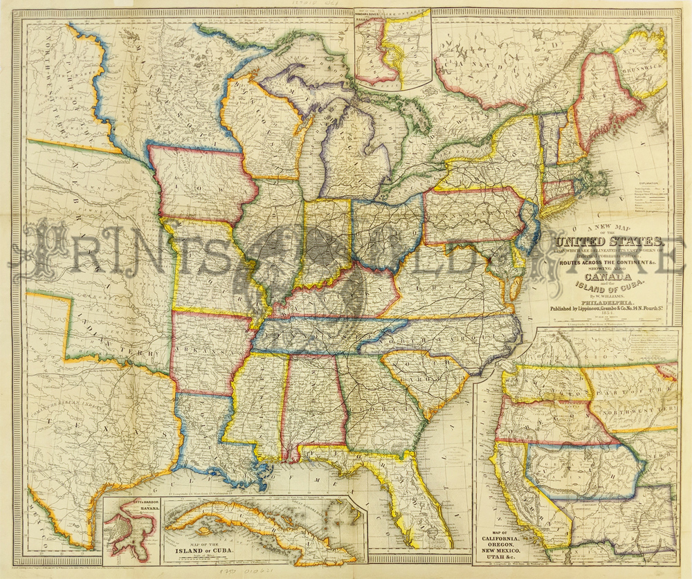
243UnitedStates:
A Map of the United States by W. Williams for
Lippincott 1854. Shows Eastern U.S. to Texas & Nebraska
Territory. Large inset of the Western Territories plus insets of Cuba,
Havana, and Niagra Falls area. A wonderful map showing pre-Civil war
development. Vibrant orignal outline colors. Some discoloration on
orignal folds.
24 1/2 x 29 in. $800
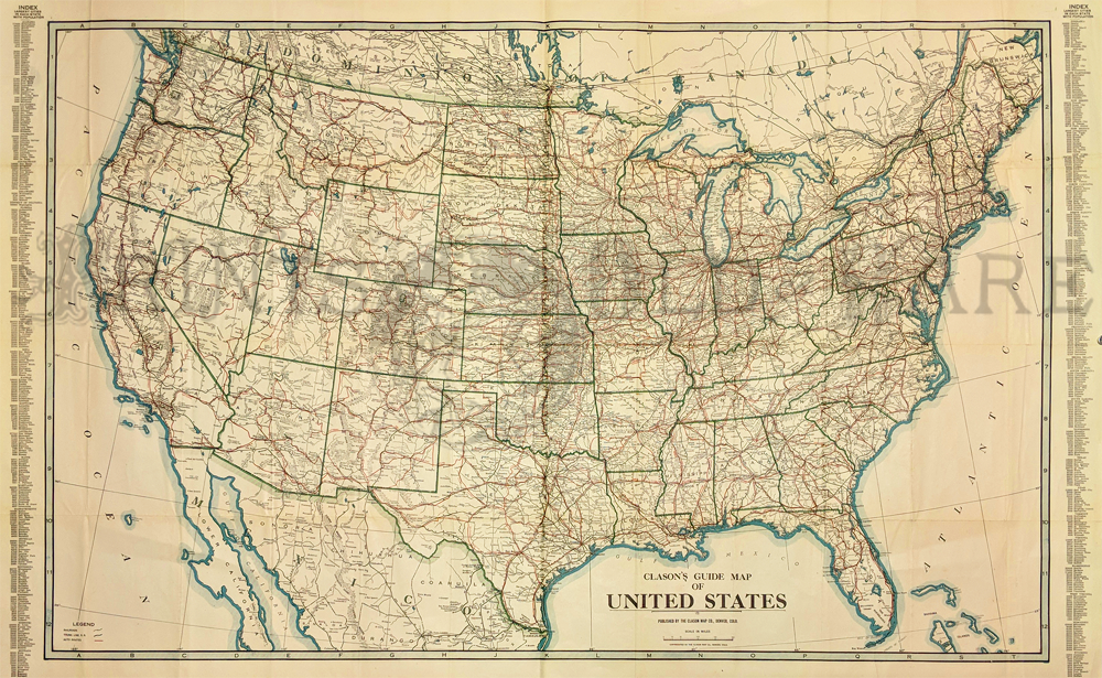
244UnitedStates:
Early
Road Map of United States 1919. Clason's Guide Map of the United
States. Shows railroad routes and lists population of large cities and
states.
21 x 36 in. $250
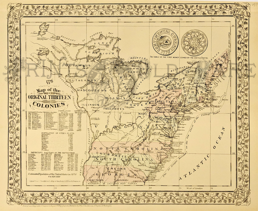
246UnitedStates:
Re-issue of 1776 Map of the original thirteen colonies.
Copied from
John Mitchell's Map of the British & French dominion 1879.
Hand colored map with inset views. Shows colonies,
settlements, Indian tribes, roads, rivers, 30 league boundary of the
coast of the United States, etc. Includes statistical tables and
Fac-simile of the first money coined by the United States also shown.
12 x 15 in. $120
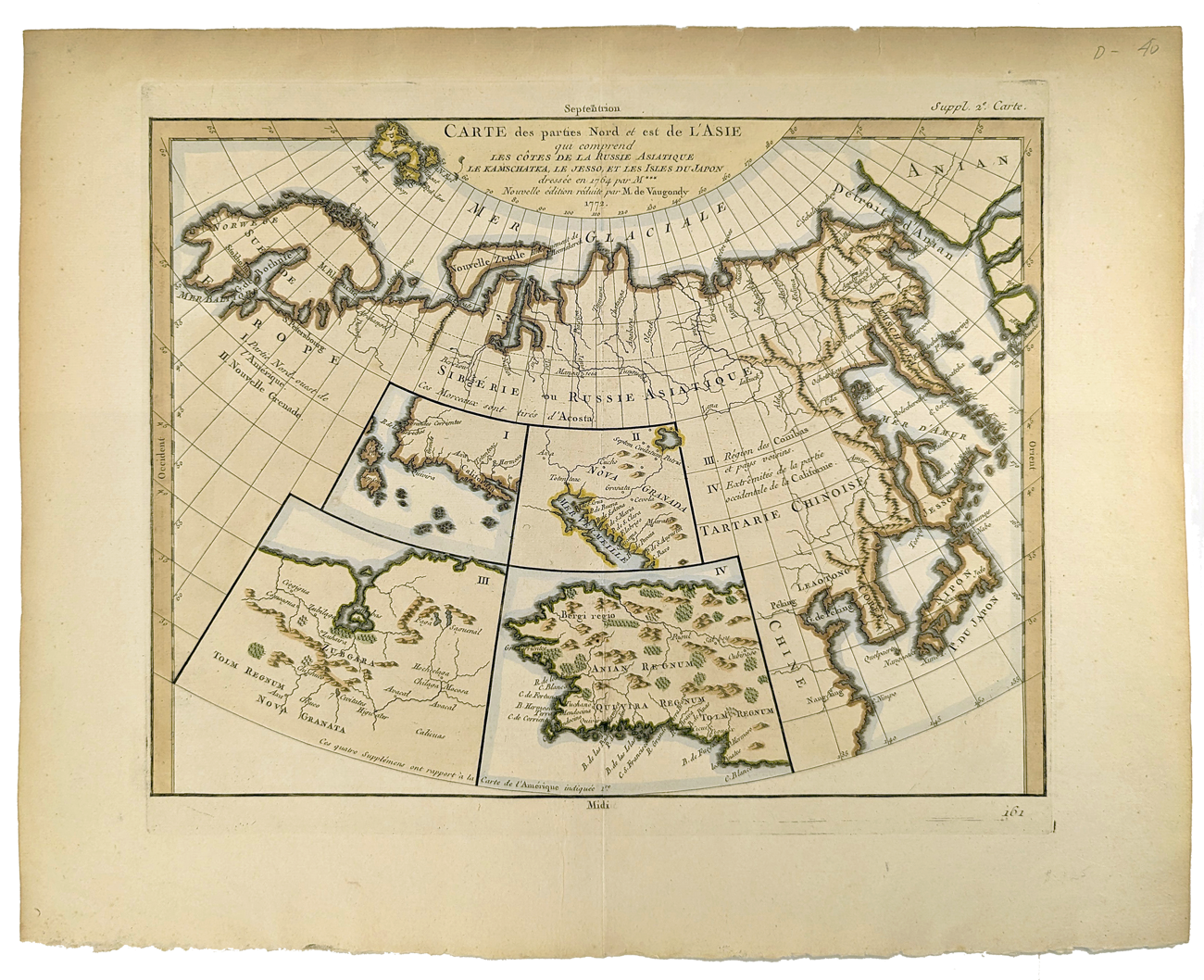
244asia:
Carte des parties Nord et est dl l'Asie. Five maps on one sheet,
showing Northern Russia territories in Europe and Asia, including the
western coastline from Siberia, with Japan and Korea. Map also shows
Bering Straits (Detroit d'Anian) and Hokaido called Jesso. Inset map of
California and Alaska. Very good condition. Wide margins.
15 5/8 x 18 3/4 in. $250
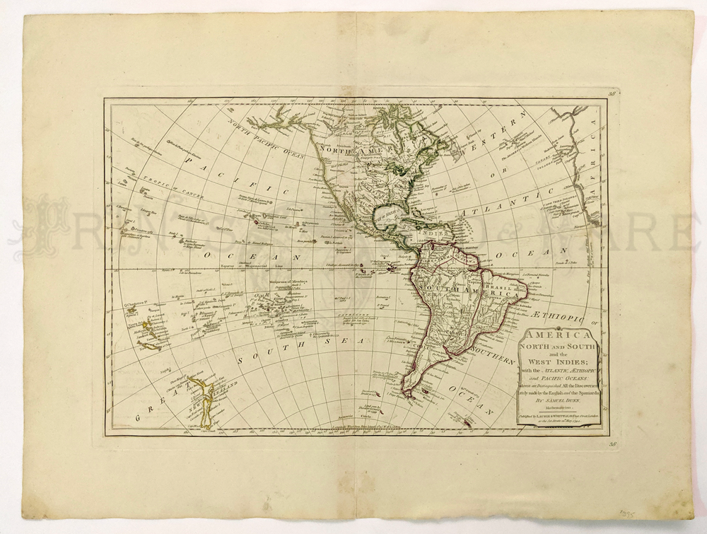
239nam:
America North & South with the West Indies 1794 by Samuel Dunn
– published by Laurie & Whittle. Uses info and details from
Captain Cook.
18 x 23 in. $395
|
Also see our North
America page
250UnitedStates:
1876 Comstock Map of the
United States and Territories. Lovely map showing states, cities,
railroad routes, lakes, rivers and topographical details. Indian
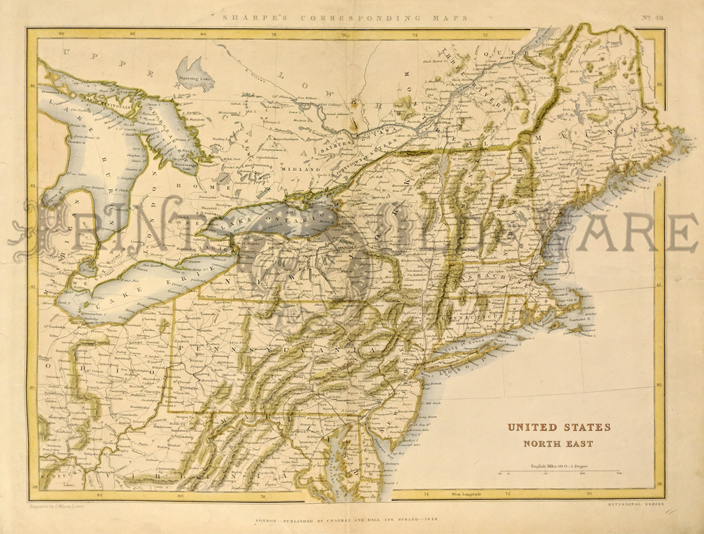
Territory is also shown. Hand colored. **Minor foxing along border edges
17 x 26 3/4 in. $150
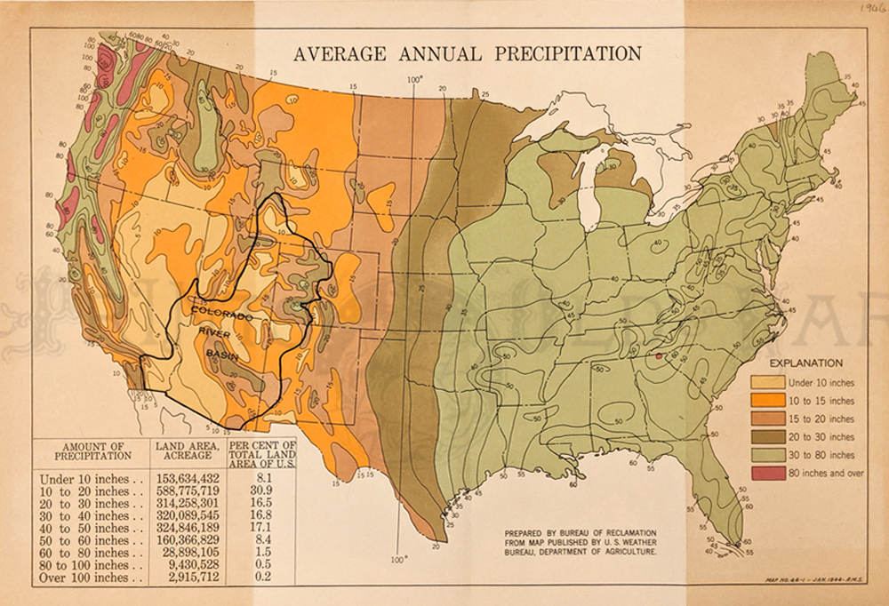
301us:
1946 Average Annual Precipitation Map. Prepared by Bureau of
Reclamation from map published by U.S. Weather Bureau, Department of
Agriculture. Showing the Amount of precipitation, land area acreage and
percent of total land area. Explanation chart showing color code on how
many inches of rain.
10 1/2 x 15 1/2 in. $80
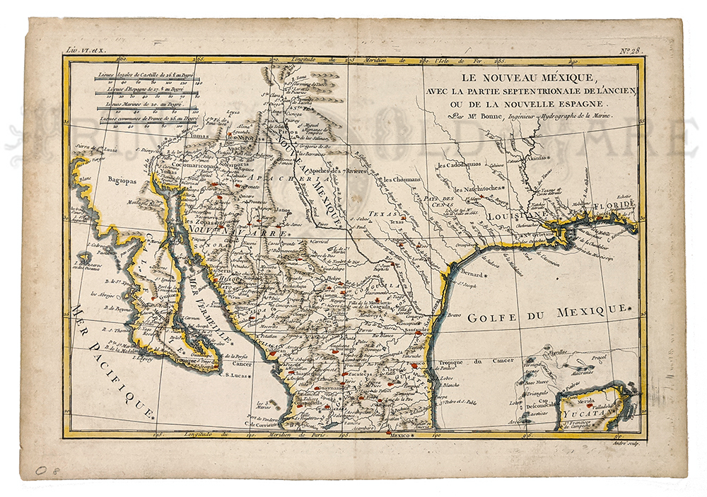
302us:
Le Novreau Mexique 1780 by R. Bonne. Shows West from Florida to
California. Hand colored, copper engraving. Shows Missions,
Settlements, Indians, and Rivers.
10 x 14 1/8 in. $350
Check
for availability
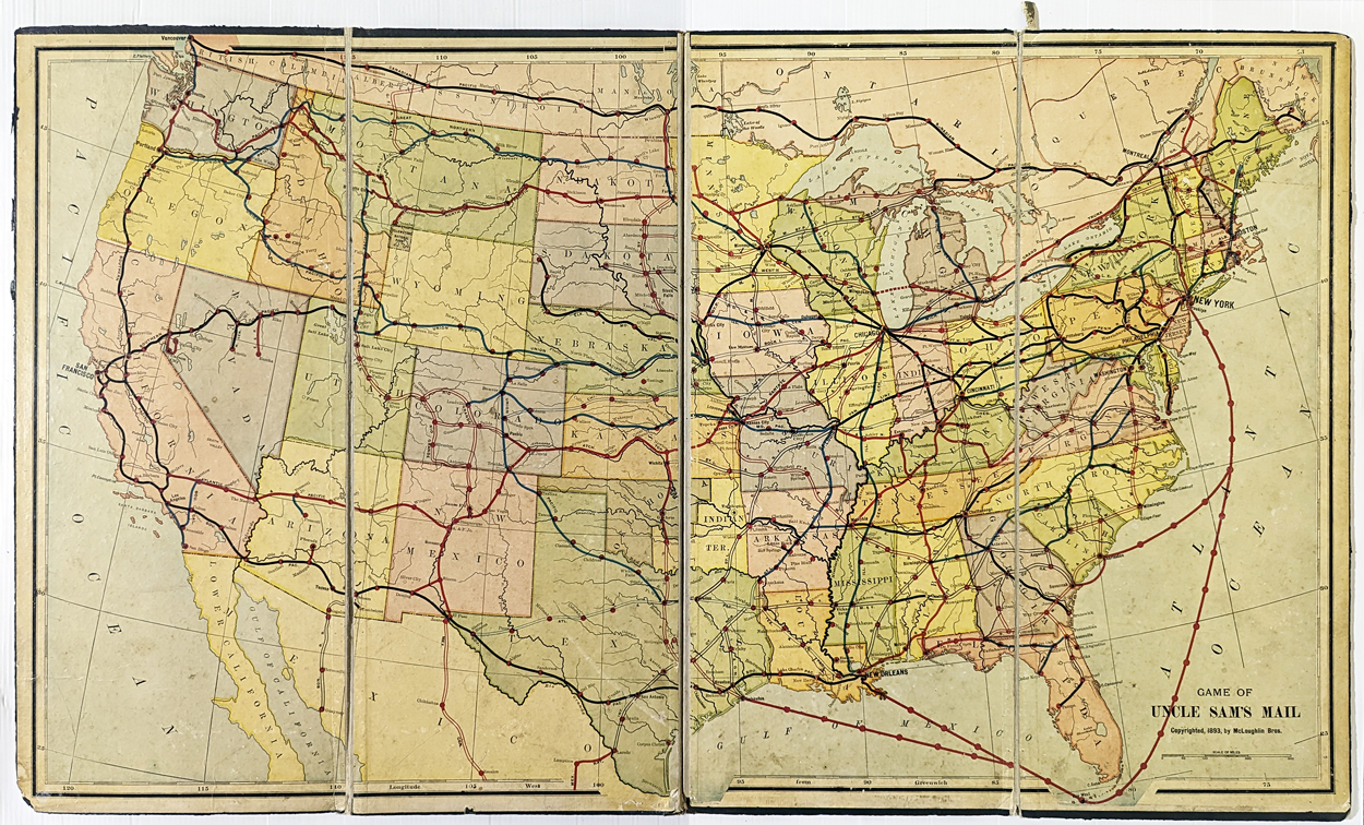
306UnitedStates:
1893 Uncle Sam's Mail McLoughlin Bros Railroad U.S. Map Game. **Board
Only. Shows wear on edges and along folds (rips/stains)
20 1/2 x 34 7/8 in. $120
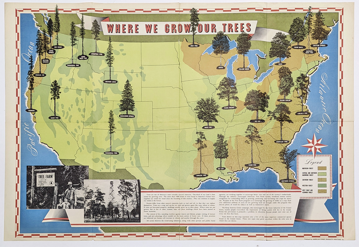
307UnitedStates:
'Where We Grow Our Trees' 1952 Pictorial Map of the United States
showing the various regions of forests and species of trees across the
country. Published by American Forest Products Industries, Inc.
Washington, D.C. **Minor tears on folds center top and bottom.
24 x 36 in. $260
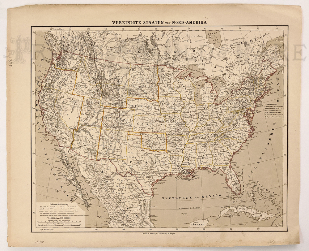
129ok:
1875 United States by C. Flemming (German) – Many western states still
in formation – Arizona, Dakota, Idaho. Very good condition.
15 ¼ x 18 ¼ in. $150
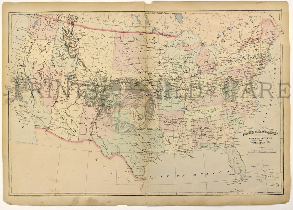
208us:
1872 map of United States and Territories. Published by
Asher & Adams in the New Statistical and Topographical Atlas of
the United States. Original hand coloring. 17.5x24.5 in. $150
213us:
1848 North-East United States map. Hand colored English map by Chapman
& Hall. Covers area from Maine to Virginia showing mountain
ranges in the area.
18.5x14.5 in. $150
224us:
1850 Hand colored Lithograph Map of United States and Territories.
Showing all the territories including Nebraska and New Mexico. Ackerman
Lithographers.
32 x 44 in. $450
244UnitedStates:
Early Road map of United States 1919. Clason’s Guide Map of the United
States. Shows railroad routes and lists population of large cities and
states.
21 x 36 in. $250
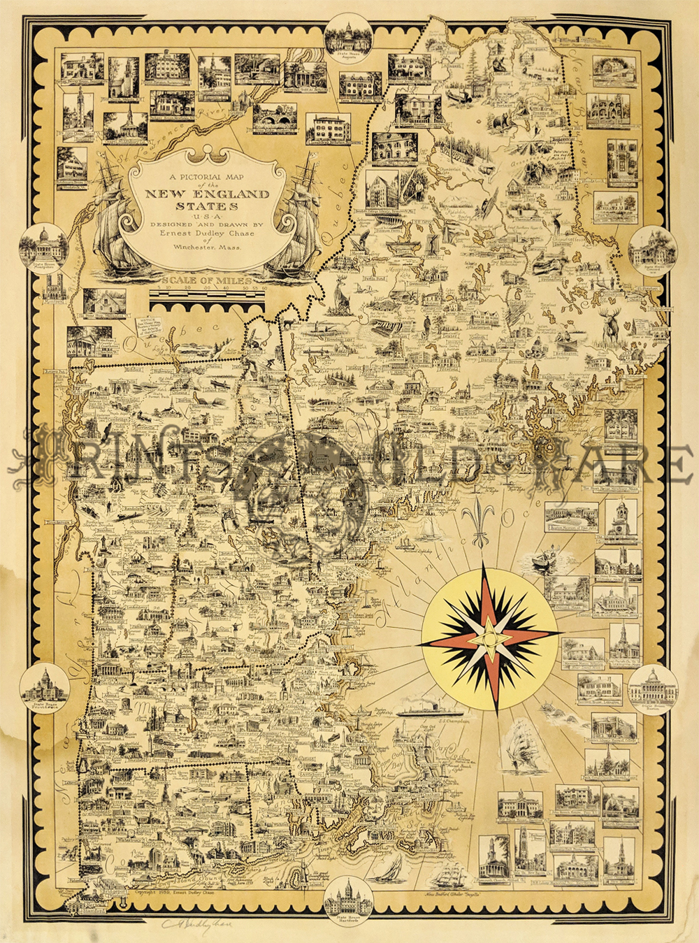
230us:
1939 Ernest Dudley Chase Pictorial lithographed Map of New England States.
Map shows cities, towns, historic sites, landmarks, buildings, animals,
and people doing recreational activities. Artist signature in pencil on
lower left margin. Beautiful compass rose. Map also includes
Connecticut, Rhode Island, New Hampshire, Vermont, and Maine. Water
damage to left margin, extending slightly into map. In margin, small
insets
of the State Houses.
25 x 19 in. $275
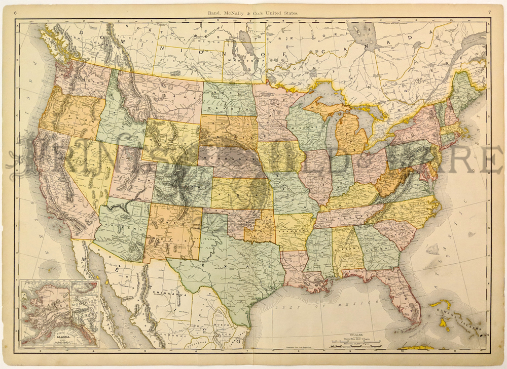
232UnitedStates:
1898 Color Rand, McNally & Co.'s full United States Map, with
inset bottom left of Alaska. Each state
is in another color.
27 x 20-1/2 in. $250
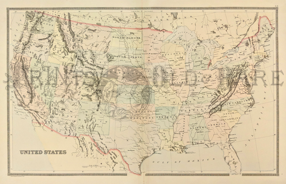
233UnitedStates:
1891 Bradley's Atlas of the World's hand colored map of the United
States, showing Indian Territory, mountain ranges, state capitols, and
other pertinent places.
26 x 19 in. $80
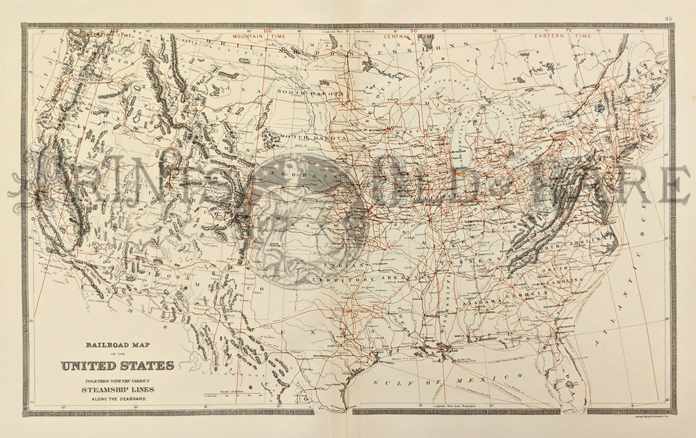
234UnitedStates:
1891 Bradley's Atlas of the World's color Railroad Map of the United
States, Together with Various Steamship Lines
Along the Seaboard.
26 x 19 in. $80
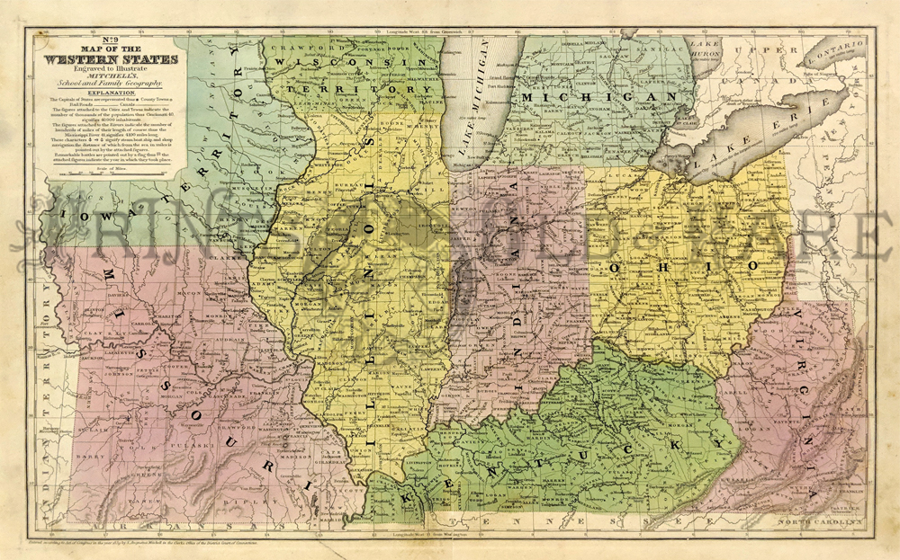
237UnitedStates:
Map of the Western States, 1839 Mitchell. Engraved and originally hand
colored map of the then Western US showing: (Iowa Territory,) Missouri,
(Wisconsin Territory,) Illinois, Indiana, Michigan, Kentucky, Ohio and
parts of Western Virginia. This map shows Lake Erie (its length of 270
miles) and all main ports and cities along southern Lake Michigan, some
of lakes Huron and Ontario. Figures attached to rivers indicate their
length. “Engraved to illustrate Mitchell's school and family
geography." Special notes include: locations of steamboat sloop and
ship navigation along with remarkable battle locations depicted with a
flag and the year they took place such as, Perry’s Victory of 1813 just
north of Sandusky City. Condition: Good, very rare, a slight tear at
bottom on fold moteling
and foxing on edges
only outside margins.
size 18 x 12 $180
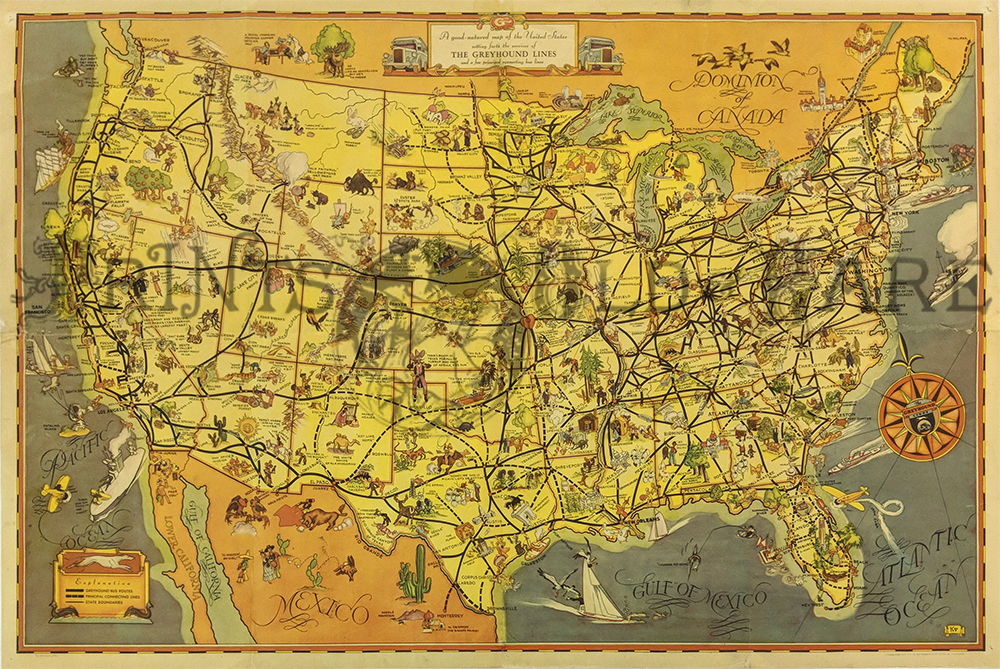
242UnitedStates:
1937 Pictorial Map of US Greyhound Lines. "A Good
Natured Map" a cartoon map of bus routes and sight seeing. Comic
illustrations. Chromolithograph
19 x 29 in. $380
Also see our:
U.S.
States and Cities
|
|